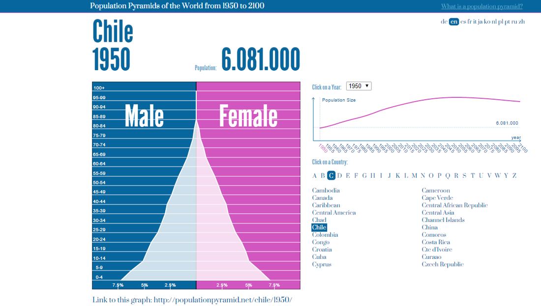
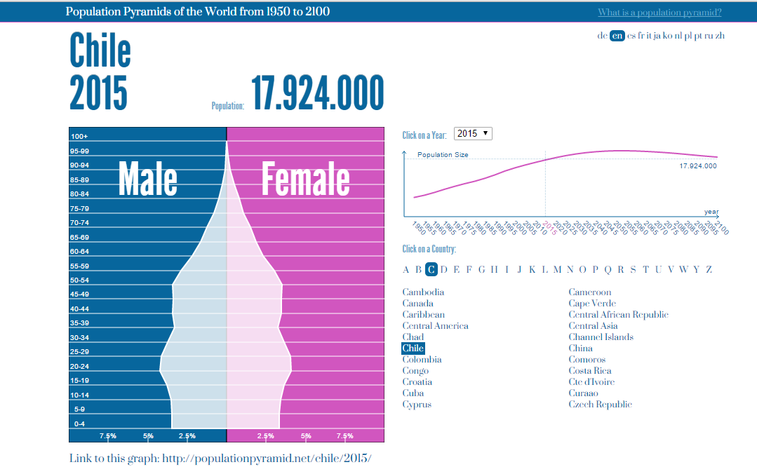
The two pyramid graphs above show the population growth of both males and females, from 1950-2015. It show the total population by age ranges. These graphs demonstrates the percentage of the population that falls within an age range. A reduction in the number of births in the country is shown when comparing these graphs. This is shown by the wide bottom of the pyramid in 1950 and how it narrows by 2015.
Chile was owned by the Spaniards in the mid-sixteenth century. This was the earliest settlement in Chile which occurred in the temperate part of the country. This is now known as Central Nucleus. The cities in the Central Nucleus were major metropolis of the country. Agriculture and industry developed with the main population. Chile's development has been tied to the success o agriculture. Cities were concentrated in the irrigated valleys. Incas were in control of the Northern parts of Central Chile. Most of the cities in Chile were founded in the colonial era. The original buildings were made of adobe and wood. Most of Chile south of the Rappel River was dominated by the Araucanian, a Native American people remarkable for its fighting ability.
By the mid-seventeenth century, the population had reached 100,000 and grew to about 500,000 by the mid-eighteen century. Those with European blood were concentrated in central Chile between Santiago and Concepcion. Most of Chile south of the Rappel River was dominated by the Araucanian's, Native American people remarkable for its fighting ability.
Chile is reowned for its rich natural diversity. The country is rich in minerals, resources, agriculture, forests, fisheries and factories. The forestry products account for a fifth of Chile's annual exports. About 90% of all the wood harvested comes from plantations of radiata pine, which is now the most abundant tree species. Chile is also home to the home to the second largest expanse of temperate rainforest.
People settled in Chile for its mineral enriched land and access to water. According the the Mediterranean climate zones table,Chile only had two different species of large grass seeds. All five species of the main domesticated mammals were from the Fertile Crescent. This meant that the population mainly relied on crops and wild animals for food. Llamas were later domesticated in South America.
Additional information can be found below.
Sources:
Chile Map -- National Geographic. (n.d.). Retrieved February 6, 2015, from http://travel.nationalgeographic.com/travel/countries/chile-map/
New Agriculturist. (n.d.). Retrieved February 6, 2015, from http://www.new-ag.info/en/country/profile.php?a=846
The Inca Empire: Children of the Sun. (n.d.). Retrieved February 6, 2015, from http://www.ushistory.org/civ/11c.asp
 RSS Feed
